Wichita, KS Severe Weather Outlook
Wichita, KS is located in Sedgwick county Kansas, roughly centered around latitude 37.6896 and longitude -97.3442 (open location in openstreetmap).
Below is the state-wide Kansas severe weather outlook. If you're interested in other states or to see the outlook for the entire US, visit the main page.
Wichita, KS Severe Weather Outlook Next 3 Days


Wichita, Kansas's NWS office: Wichita, KS (ICT)
Wichita, Kansas's National Weather Service forecast office is Wichita, KS . Its short name is ICT . You may see this code referenced in URLs and forecasts. For instance, the direct URL for your local NWS office is https://www.weather.gov/ict/
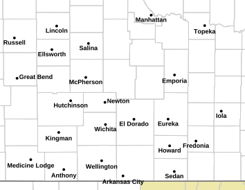
Wichita, KS (ICT) County Warning Area
Different NWS offices are responsible for the forecasts and warnings for different counties/parishes/boroughs. This geographic region is called the County Warning Area (CWA). The CWA borders can sometimes seem quite arbitrary.
Your NWS office is responsible for 26 different counties: Allen, KSBarton, KSButler, KSChase, KSChautauqua, KSCowley, KSElk, KSEllsworth, KSGreenwood, KSHarper, KSHarvey, KSKingman, KSLabette, KSLincoln, KSMarion, KSMcPherson, KSMontgomery, KSNeosho, KSReno, KSRice, KSRussell, KSSaline, KSSedgwick, KSSumner, KSWilson, KSWoodson, KS
Here is today's severe weather outlook highlighting the counties that the Wichita, KS
NWS office is responsible for:

Current hazard map for Wichita, KS and the surrounding area
Click the image to go to the Wichita, KS NWS site to find out more about
the current hazards.
For reference, see the US hazards map below. However, if there are any
hazardous weather outlooks in effect (this is their color)
, they will appear on the local map above, but not on the national
map below.

Tweets from the Wichita, KS NWS office
Location details for Wichita, Kansas
- Latitude: 37.6896
- Longitude: -97.3442
- Zip codes: 67230 67235 67260 67217 67216 67215 67214 67213 67212 67211 67210 67219 67218 67223 67220 67226 67202 67203 67204 67205 67206 67207 67208 67209 67201 67275 67276 67277 67278
- Zip codes: 67230, 67235, 67260, 67217, 67216, 67215, 67214, 67213, 67212, 67211, 67210, 67219, 67218, 67223, 67220, 67226, 67202, 67203, 67204, 67205, 67206, 67207, 67208, 67209, 67201, 67275, 67276, 67277, 67278